On 30th September 2014 I set off to walk around Canvey Island's coastline a total of 14 miles.
I met Donna at Benfleet Station and set off from there,across the bridge and onto Canvey Island.In the Benfleet Creek were loads of Little Egrets amongst other Water Birds.
After a little bit of walking we were in the
RSPB reserve (West Canvey Marsh) and walking up towards the seawall.
Canvey Island is a reclaimed island in the Thames estuary. It is separated from the mainland of south Essex by a network of creeks. Lying only just above sea level it is prone to
flooding at exceptional tides, but has nevertheless been inhabited since
the
Roman invasion of Britain.
The island was mainly agricultural land until the 20th century when it
became the fastest growing seaside resort in Britain between 1911 and
1951.
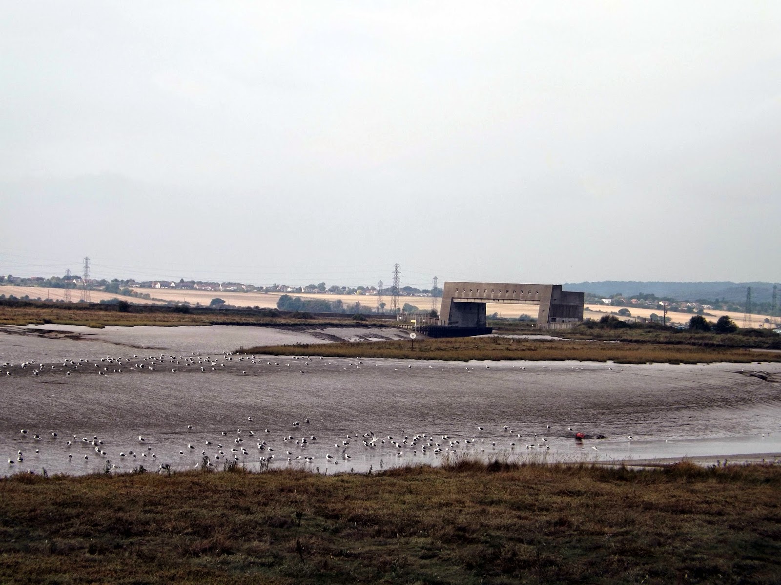
A little further along the seawall, we come across some flood gates, Canvey now has these and miles of concrete seawall to protect it after the devastation of the
1953 floods that claimed 58 lives.
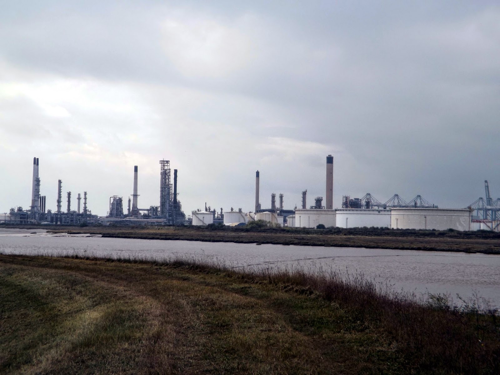
Now as we follow the path round we pass
Coryton Oil Refinery across the water between
Shell Haven Creek and Hole Haven Creek, which separates
Canvey Island from the mainland.
In January 2012
Petroplus
filed for bankruptcy. Coryton Refinery ceased production in June 2012.
The site will be turned into a distribution terminal to be called Thames
Oil Port.
In 1895 the ammunition firm
Kynochs built an explosives factory at the site and closed in 1919.
The site and CLR were taken over by coal merchants
Cory Brothers
Ltd of Cardiff to build an oil storage depot, with Kynochtown renamed
Coryton. Sources differ as to whether Corys, who sold a well-known brand
of petrol,
Corys' Motor Spirit, also built a refinery at the site.
In 1950 Coryton and the CLR were sold to the American
Vacuum Oil Company, later
Mobil.
The CLR to Corringham was closed, but the branch from Thames Haven was
upgraded to main-line standards. A new refinery came on stream in 1953.
Coryton village was demolished and absorbed into the refinery site in
the 1970s.
Coryton was operated by
BP
from 1996, when Mobil's fuels operations in Europe were placed into a
joint venture with BP. Following the merger in 1999 of Mobil with
Exxon, the remaining interest in the refinery was sold to BP in 2000.
In 2007 the plant was sold by BP to
Petroplus for £714.6m (around $1.4 billion).
On 24 January 2012 it was announced that Petroplus had filed for bankruptcy, putting the refinery's future into doubt.
Now with no signs directing us, we came up to a road and had to double back to try and find the path which will take us back to the seawall.
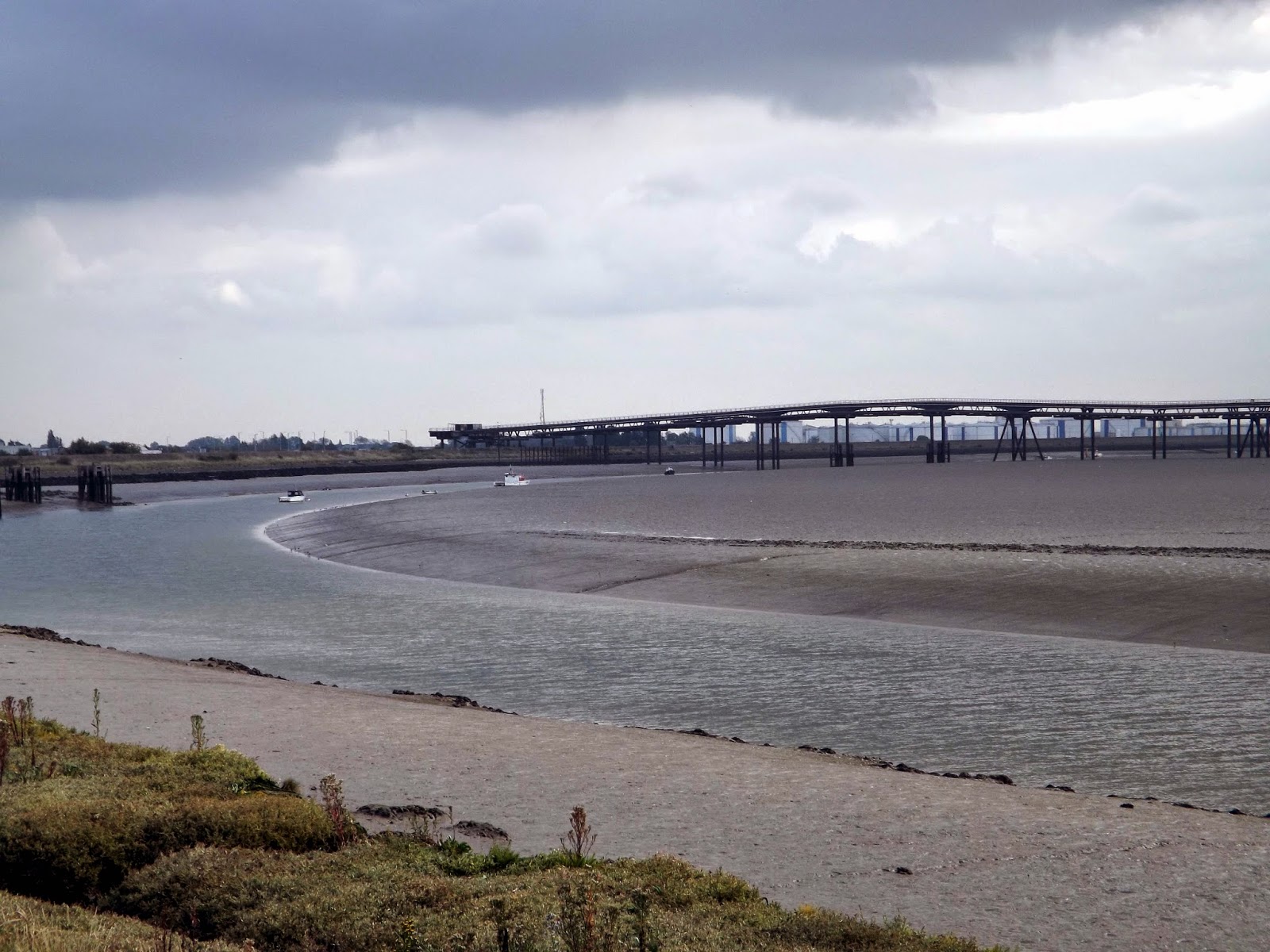
 |
| Occidental Jetty |
Planning permission was granted in the following years for
Occidental Petroleum and the Italian oil company, United Refineries Ltd to develop a site further west for the construction of an
oil refinery,
but a report in 1975 by the Health and safety executive concluded that
the residents of the island faced an unacceptable risk, which led to the
permission being revoked.
The issue of risk was again highlighted in an attack by the
IRA in January 1979 on a storage tank at the island's
Texaco
oil terminal. A bomb was detonated at a tank containing aviation fuel,
but failed to ignite with the fuel escaping into a safety moat.
The Occidental site was abandoned in 1975 leaving a half-built oil
refinery, storage tanks, and an unused mile long jetty which cost around
£10 million of the approximate total of £60 million spent on the
project.
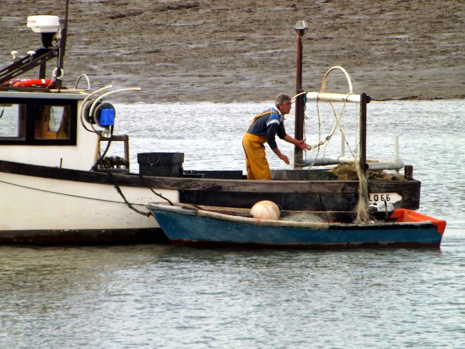
We are now walking through the area known as Hole Haven on Canvey Island.
Once back on the seawall it wasn't too far until we reached
The Lobstersmack PH where we stopped for a drink. I ordered a lovely pint of Doombar and sat out the front.
The
Lobster Smack Public House at the southwest corner of the
island is a grade II listed building dated to the 17th century. The pub
was known to
Charles Dickens who mentioned it in
Great Expectations.
Alongside the pub is a row of wooden Coastguard cottages that date from
the late 19th century which are also of grade II listed status.
This little inn was weathering storms on
the sea front at Hole Haven, Canvey even before marauding sailors from a
Dutch man of war launched an invasion here in 1667.
We left the pub and continued on our way past more industry and the Calor Gas plant.
Calor Gas Ltd has been fined more than £27,000 for breaching health and
safety regulations after a major leak at the company’s terminal on
Canvey Island saw the release of 163 tonnes of lpg in 2008.
Now we have passed the industrial side of Canvey and walking up to Thorney Bay passed Deadmans Point.
As we round the corner we follow the seawall up to
The Labworth Cafe, its a lot busier now with plenty of people milling about enjoying the sunshine
The Labworth Café is a pioneering modernist International Style reinforced concrete building overlooking the Thames ERstaury at Labworth beach. Built in 1932–1933 by
Ove Arup to resemble the bridge of the
Queen Mary, it exists as the only building solely designed by the distinguished engineer. Ove Arup went on to build The Sydney Opera House in Australia.
By the 1990s the cafe was in a state of disrepair, but it was awarded the status of a
Grade II listing in 1996 by
English Heritage and then bought in 1998 by local businessman and lottery winner
Chris Topping.
The
Labworth was consequently refurbished, and reopened in the late 1990s with the first floor functioning as the
Labworth Restaurant. In 2001, a cafe was added to the ground floor and the building reopened as the
Labworth Restaurant and Beach Bistro.
After we passed the Labworth we reach Canvey's seafront with Amusements,funfair and cafes. Donna left the walk here to get home. I pushed on hoping to complete the whole island in a day.
I passed the Concord Cafe where there is a small sandy beach and a paddling pool that fills with sea water and is usable after the tide has gone out. The cafe here does hot and cold food and drinks. The chips are superb! I spent many a happy time here as a kid and later when I moved to the island for 5 years.
I walked on a little further past the Windjammer from where I seem to remember being barred after a drunken Stag Night with friends and family. I could just see my old bungalow but its changed round here there are now high flats on the green and the it seems I couldn't walk down to the road from the Seafront.
I now walked passed Chapman Sands Sailing Club, where I once went out crewing on a Catamaran in a race. I also had a little dingy I left here which I launched from their jetty for a bit of sea fishing.
 |
| Concord Rangers FC |
I now round the tip of the Island and walk up towards The Point.
I now reach the
Island Yacht Club , which I walk pass and tucked behind is the footpath that leads me up to
The Point.
 |
| View from The Point across to The Isle Of Grain in Kent. |
Canvey Point is situated in the easternmost part of
Canvey Island in the borough of
Castle Point,
Essex.
Canvey Point is commonly referred to as just "The Point" by most residents of Canvey Island.
It is reputedly haunted by the ghost of a Viking invader, searching for his ship.
I now double back up the footpath and continue my way along the seawall with ships and boats on my right with houses and industries on my left.
 |
| Views across to Hadleigh Castle. |
I enter
Canvey Heights Country Park. This was once a landfill site called Newlands Hence its height, that has been transformed into a park with superb views across to Hadleigh,Westcliff,Leigh on sea and Southend On Sea.
The Country Park is part of a Greengrid project that aims to transform
an
old landfill site previously known
as Newlands - See more at: http://www.essexmums.org/placescanveyheights.html#sthash.ta5Hkkck.dpuf
The Country Park is part of a Greengrid project that aims to transform
an
old landfill site previously known
as Newlands - See more at: http://www.essexmums.org/placescanveyheights.html#sthash.ta5Hkkck.dpuf
The Country Park is part of a Greengrid project that aims to transform
an
old landfill site previously known
as Newlands - See more at: http://www.essexmums.org/placescanveyheights.html#sthash.ta5Hkkck.dpuf
 |
| Views to Westcliff On sea |
 |
| Views to Hadleigh Castle |
 |
| Hadleigh Castle |
I now follow the seawall along past the Golf Club before arriving back at Benfleet Station for the journey home. I'm knackered but what an amazing day with superb weather.
In 1622, Sir Henry Appleton (a descendant of John de Apeton), and Canvey's other landownersinstigated a project to
reclaim the land and wall the island from the
Thames. The scheme was managed by an acquaintance of Appleton's - Joas Croppenburg, a Dutch
Haberdasher of
Cheapside in
London.
An agreement was reached in 1623 which stipulated that in return for
inning and recovering the island, the landowners would grant a third of
the land as payment for the work
the work was completed by around 300 Dutch skilled in the construction of
dykes and other sea defences. The engineers successfully reclaimed 3,600 acres (15 km
2)
by walling the island with local
chalk,
limestone and the heavy
clay of the marshes, with the main length along the Thames faced with
kentish ragstone.
Approximately one-third of Canvey's streets have names of Dutch origin.


No comments:
Post a Comment